1. Location My Hao district is located in the north-east gate of Hung Yen province. My Hao is a district located in the North Delta, in the northeast of Hung Yen province; My Hao has administrative boundaries as the following: ...
The North: borders with Van Lam district;
- The South: borders with An Thi district;
- The West: borders with Yen My district;
- The East: borders with Cam Giang district and Binh Giang district (Hai Duong province).
My Hao district has an administrative area of 7,910.96 hectares and population of 152,605 people (as of December 31, 2014), on the transportation route from Hanoi to the northeastern region and the development belt of Highway 5A economic-technical corridor. My Hao district is located in the key industrial area of Hung Yen Province and the Northern Delta.
Regarding inter-provincial relations, My Hao district is an industrial development center of the northern key economic region, influenced by the important economic-technical-economic corridor of the North, including National Highway 5A, National Road 39A, Highway 38, Ha Noi - Hai Phong expressway, Hanoi ring road 4, Hanoi - Hai Phong railway. As a result, My Hao has a close link with the northern region, Hai Duong, Hanoi, Hai Phong, northern seaports and Noi Bai International Airport.
My Hao District is one pole in the northern industrial triangle of Hung Yen Province (Nhu Quynh - Van Giang - Pho Noi). It is an industrial, service and financial center of Hung Yen Province.
In addition, My Hao district has a close relationship with neighboring development centers such as Bac Ninh province, western part of Hai Duong province. The main relation is in the field of service, production and consumption of agricultural products. In which, My Hao is a province with many manufacturing centers, supporting production and trade promotion in the above areas (such as producing construction materials, trading industrial equipment, means of transportation, handicrafts and fine arts).
2. Natural condition
Location and climate
- Terrain: My Hao district is located in the Red River delta, with fairly flat terrain. The average ground slope was very small, from 0.001% to 0.008%; Main slope is from North West to South East; the average natural background height is from 2.5m to 3.5m.
- Climate: The district is located in the Northern Delta, affected by the tropical monsoon climate with hot and humid rain with 4 distinct seasons: spring, summer, autumn and winter. This climate is well suited to a wide variety of crops, facilitating the development of commodity-based agriculture. However, measures must be taken to prevent floods, storms and other weather disasters.
Hydrological
My Hao district is affected by the hydrographic regime of the Red River through the branches of Bac Hung Hai river (passing through the southern part of the district) and Cuu An river (passing through the eastern part of the district).
- Red River runs along the western boundary of Hung Yen Province, about 15kms westwards of My Hao District. The river is 3 to 4 km deep, with many large sandy beaches, the water level in dry season is + 1.58 m, that in flood season is + 4.7 m. The average flow is 850 - 950m3 / s, the highest flow in the flood season is 8.160m3 / s, the lowest flow in the dry season is 105m3 / s. In the dry season the flow rate of the water fluctuates around 0.2: 0.4 m / s, that in flood season is 1.3: 1.5 m / s. The width of the river is 500 - 1,000m, the peak flood with the alarm level I is 9.5m.
- Bac Hung Hai river: runs through Nam Huyen border in Ngoc Lam commune and Hung Long. The part running through the district with 6 kms in length; 70: 100m in width, the flow of 75 - 105m / s, the river water level is regulated at + 2.0m, the level in the rainy season can reach up to + 4.2m.
- Cuu An River, which is a separation of the Red River and a major branch of Bac Hung Hai Irrigation System, runs through the boundary of the Southeast District with a length of about 4 km and a width of 50 - 130 m. The important part is to stabilize irrigation water for agriculture in the whole region and My Hao district. River water level is also regulated at 1.9 m, in rainy season it can reach up to + 4.4 m.
- Provincial inland river channels including Ban Vu Xa (15km), Tran Thanh Ngo canal (7.25km) and Cau Luong river play an important role in irrigation and drainage for production and life in the district. In addition, the district also has a system of lakes, dams, rivers, and other small intra-canal channels, wherever the regulation of the pump system is necessary
- Due to Bac Hung Hai irrigation system, the floods only occur in the Red River and do not affect My Hao district. In the district, very few areas are regularly flooded (including the lowest in the southeast of the district).
3. Establishment history and development
My Hao was reclaimed from the time of Hung King. At that time, this land was just the area of soil, heaps which were raised by the Red River accretion and emerged between marshes and reeds swamp, sparsely populated with the main occupation of fishing and agricultural production.
In Van Lang - Au Lac dynasty, My Hao area belonged to Duong Tuyen (Thanh Tuyen). According to “Đại Nam nhất thống chí”, My Hao district is now called Duong Hao district from the end of Northern period (9th-10th centuries). After many splits, in 1885 (in the first Dong Khanh year), Nguyen Dynasty changed the name from Duong Hao district (Hai Duong province) to My Hao district in order to avoid the King’s name including “Duong”
On February 25, 1890, List of Governors-General of French Indochina issued a decree establishing Bai Say, which included parts of the province from Bac Ninh, Hung Yen and Hai Duong. Bai Say was divided into four districts: Van Lam, Cam Luong, Yen My, My Hao, the capital is located in Ban Yen Nhan (My Hao). My Hao district consists of 4 districts of Duong Hao district after the establishment of Yen My district. In the third Thanh Thai (1891), List of Governors-General of French Indochina issued a decree to abandon Bai Say, bringing Van Lam, Yen My and My Hao districts into Hung Yen province.
The urban territory of My Hao today is Pho Noi, Pho Ban, Pho Thua of Hung Yen province. Before August revolution in 1945, this was one of the few centers of trade and service in the border areas of Hung Yen, Hanoi, Bac Ninh and Hai Duong. This was also a place where people were gathered for trade, culture and work activities and connected with the important French military zone in the northern region until 1945 (Bot Ban). So Pho Noi, Pho Thua is famous for an inter-provincial trading center, a traffic hub of Northern Delta between 5A and 39A national road. After August revolution in 1945, the Democratic Republic of Vietnam rearranged the hamlets and villages of My Hao district and re-established 14 communes and reduced to 13 communes in 1961. On March 11, 1977, the Government Council issued Decision No. 58 / CP consolidating some districts of Hai Hung; in which Van Lam district and My Hao district were unified into Van My district. Then, on March 24, 1979, the Government Council issued Decision 70 / CP to revise the boundaries of 13 districts in Hai Hung Province and merge into 7 new districts. Van My district was added 14 communes under Van Yen district, named My Van. In this period, My Hao area belonged to My Van district, Hai Hung province.
After Hung Yen province was re-established in 1997, on September 1, 1999, My Hao district was re-established according to the Decree No. 60 / ND-CP of the Government with the total area of 7,911 ha, consisting of 13 administrative units. Ban Yen Nhan and 12 communes (Nhan Hoa, Di Su, Bach Sam, Phung Chi Kien, Minh Duc, Hoa Phong, Cam Xa, Phan Dinh Phung, Hung Long, Xuan Duc, Ngoc Lam and Duong Quang).
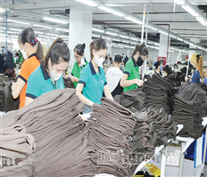
From 1999 up to now, implementing industrial development strategies of Hung Yen province, large national industrial parks of the national scale and provincial scale were built in My Hao such as Pho Noi textile industrial park, Thang Long II Industrial Park (100% foreign owned), Minh Duc Industrial Park; At the same time, local industrial sites in Ban Town, Nhan Hoa Commune, Di Su Commune, Phung Chi Kien Commune, and Minh Duc Commune were also developed. By 2013, the total area of industrial and handicraft projects in My Hao district was 7.06.31 ha. The achievements of industrial development in My Hao have made great contribution to bringing Hung Yen province into the northern key economic region.
In this stage, 5A and 39A national road and some traffic items in My Hao district were upgraded and newly constructed such as: TL380, TL387, Quan Khoi bridge, Pho Noi, Bach Sam, which leads to appearance of some regional service center along National Road 5A and 39A national road. Old streets such as Pho Ban, Pho Thua, Pho Noi have been developed and boosted the urbanization of the area. Up to now, My Hao has been an industrial and service center of Hung Yen province.
Over many historical periods, My Hao is a significant place in the development of Hung Yen and the Red River delta in general. My Hao district is also known as the land of prosperity with typical industries such as Tuong Ban which is one of the 10 most famous sauces of Vietnam and furniture production in Hoa Phong. My Hao is also known as the land of "spirituality masterpiece", "learning land" associated with the names of famous scientists such as Nguyen Thien Thuat, Giap Trung, and Pham Sy Ai. My Hao is referred to the land rich in patriotic and revolutionary traditions, where there are many generals, heroes of armed forces and Vietnamese heroic mothers. In 1996, My Hao District was awarded the title of Hero of the People's Armed Forces.
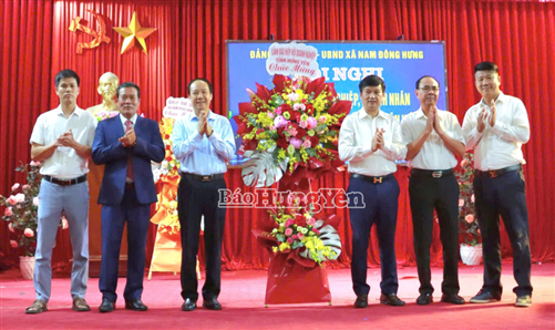
Received the assistance of central and provincial authority, My Hao urban area, on the foundation of Ban Yen Nhan town, has developed in line with the orientation of the national urban planning system, in accordance with the construction planning of Hung Yen province, general planning of construction of My Hao district and My Hao urban development program until 2020. By the end of 2014, the technical infrastructure system and urban center have been basically synchronized with efficient exploitation of natural resources, environmental protection and preservation of cultural heritages in orders to improve the quality of urban development and the quality of life of the people. My Hao district has qualified for the proposal to establish My Hao town
4. Administrative units
Located in the northern part of the province, the district borders with Van Lam district to the north, An Thi district to the south, Hai Duong province to the east, Yen My district to the west. There are 13 administrative units, including 12 communes and 1 town with a total area of 79.10 square kilometers, namely:
The administrative area of Ban Yen Nhan is 5.74 km2
The administrative area of Phan Dinh Phung is 7.52 km2
The administrative area of Cam Xa is 8.91 km2
The administrative area of Duong Quang is 7.75 km2
The administrative area of Hoa Phong is 7.54km2
The administrative area of Nhan Hoa is 6.22 km2
The administrative area of Hung Long is 4.65 km2
The administrative area of Di Su is 6.70 km2
The administrative area of Bach Sam is 4.53 km2
The administrative area of Minh Duc is 5.53 km2
The administrative area of Phung Chi Kien is 4.44 km2
The administrative area of Xuan Duc is 4.24 km2
The administrative area of Ngoc Lam is 5.44 km2
5. Society and economy
Before separation, My Hao belonged to My Van district of Hai Hung province with the living was mostly based on agricultural production. By September 1999, My Hao district was officially re-established. Promoting the advantage of geographic location and the wise guidance of the Party, authorities and local people have transformed the economic structure according to the criteria of "taking industry as the focus, considering agriculture as the key”, which quickly brings My Hao district into the dynamic economic area of Hung Yen province.
Industry and handicraft industry
At the time of re-establishment, My Hao faced many difficulties: low starting point, limited natural resources, and effect of subsidy mechanism. The solution to the problem of socio-economic development was revealed in the Resolution of the 22nd Party Congress. Accordingly, the district needs to utilize and promote all available resources, outsource investment to create new strength, and take industry and handicraft industry as the leverage for socio-economic development. .
However, implementation is the process of striving hard and included many difficulties. The only internal resources of the district are land and people. However, the land fund is limited and people are familiar with the old self-supply and old mindset, which are major obstacles for economic development. The Party committees, authorities and people of My Hao have quickly embarked on the process of industrialization and modernization for the first steps, namely the revitalization of trade villages, the implementation of policies in order to attract investment, create conditions for the economic restructuring in proportion with the direction of rapidly increasing the proportion of industry and services, and gradually reducing the proportion of agriculture.
After 4 years of efforts to cling to this direction, My Hao has achieved an average growth rate of 27.9% per year (2000-2004). In 2004, the district attracted 118 projects with a total investment capital of VND1,810 billion. Of which, 37 projects have come into operation effectively, attracting over 10,000 workers (50% of local workers). Particularly, by 2016, the total value of industrial and handicraft production was estimated at VND12,257.9 billion, up 9.8% compared to 2015. The production value is mainly concentrated in the region of non-state owned enterprises which accounted for VND 9,653, up 9.5%. The individual business households reached 588.4 billion, up 10%; Foreign invested sector reached 2,016.5 billion, up 11%.
The district has 1,409 handicraft production establishments, attracting 5,246 laborers, creating a goods value of VND 63,936 billion, accounting for 10.6% of the industrial production value in the locality.
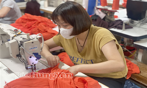
The investment projects for industrial development in the district are rapidly increasing. By 2016, the total number of projects was 167 projects, of which 135 have been put into operation, attracting more than 18,000 laborers. Over 60% of the workforce is local residents. The restoration and development of trade villages are interested and bringing practical results. My Hao district has 11 handicraft villages including 7 well-developed ones. In particular, it is remarkable that the production of traditional Tuong Ban is famous nationwide. Other industries and handicraft sector are concentrated in garment, food processing, building materials, plastic recycling and household goods.
5.1. Agriculture
Together with the development of industries and handicrafts, My Hao district authorities pay special attention to the restructuring of the agricultural economy. In 2016, total agricultural production value was estimated at VND 687.5 billion, up 1.3% compared to 2015, of which: cultivation value is VND 272 billion, decreasing 1.1% (decreasing by 37 hectares with 2015); value of animal husbandry reached 330.2 billion, up 3.3%; aquatic product value reached VND45.24 billion, up 1.8%; The value of agricultural services reached VND 40.1, up 1.5%. The proportion of husbandry and aquacultur are 42% and 58% respectively
The agricultural land area of the district is 4,789.1 ha; of which the paddy land area is 7,858 ha (for both seasons) and evenly distributed in communes (the area of high quality rice is estimated at 79.5% of the cultivated area); Land for aquaculture is 587.8 ha, accounting for 12.2% of the agricultural land, distributed mainly in the south of Minh Duc commune (Bac Hung Hai river). The remaining area is scattered in Hung Long, Xuan Duc, Cam Xa, Hoa Phong and Phan Dinh Phung communes.
Cultivation: the district focuses on renovating the crop structure, rearranging the rice crop, investing in short-term varieties with high productivity and promoting the production of commodity rice. By 2016, the area of winter crops is 210 hectares, the total area of rice cultivation is 7,858 hectares. Organizing cultivation is to ensure the quality of the area and frame of crop. The area of quality rice is 6,245 ha, accounting for 79.5% of the total area. The annual yield of rice reached 120.5 quintals per hectare (spring crop reached 63.5 quintals per hectare, the season crop reached 57 quintals per hectare); The paddy output is estimated at 47,341 tons. The actual value per 1ha of cultivated land is estimated at VND 98 million (reachedc 95 million dong in 2015).
Animal husbandry: The livestock sector has developed stably and extensively. Farm models have been established. The quality of livestock products has been improved through the introduction of new breeds. The leanization program, and crossbreeing cattle program continue to be carried out and effective. In 2016, pork output is 6,933.5 tons, up 2.1%; buffalo and beef reached 202.3 tons, up 5.4%; poultry reached 2,210.7 tons, up 5.6%; Other livestock production reached 81.1 tons, up 16%; the output of eggs of all kinds was 15.5 million, up 13.5% compared to2015. The area of aquaculture was about 380 hectares, high value aqua products are put into production such as: caps, catfish, tilapia.
With the encouragement of the People's Committee of the district, the model of farm economy development has been expanded. There are about 450 farms, of which 35 farms meet the criteria. The district has renovated, upgraded and built a number of irrigation works, rural infrastructure to ensure timely service of agricultural production.
5.3. Trade and service
State commercial service works are concentrated mainly along the National Road No. 5 in Pho Noi, such as the Tax Department, the State Treasury, the Post and Telecommunication, Insurance, markets.
Other services such as passenger transportation service, banking, financial services, services for industrial production such as investment consultancy, material supply, labor supply are quite developed.
Commodities in the district are diverse and abundant, the price is quite stable to meet the needs of the people. Total value of trade and services in 2016 of the whole district is estimated at VND5,527.4 billion, up 16.2% compared to 2015, of which the total trade turnover reached VND4,845.4 billion, up 15.7% %. Hotel and restaurant sector reached VND223 billion, up 19.3%. Tourism and services reached 459 billion, up 18.7%. Total retail turnover in 2016 was estimated at VND2,162.6 billion, up 20% compared to 2015. Export value was estimated at USD77.6 million, up 17% compared to 2015. The acthorities work with branches of the province to conduct examination and speculation in smuggling, banned goods, counterfeit goods and commercial frauds in order to stabilize market prices and avoid price crisis.
The market system in the area is maintained stable, contributing to the circulation of goods and serve the needs of the people. The network of post and telecommunication services has been strongly developed, infrastructure services have been invested and improved in all aspects. The district is improving the efficiency of the system of public service works (marketplaces, trade centers, trade streets, in order to boost up the local socio-economic development).
5.4. Transportation, basic construction:
The transportation system continues to be invested, the quality has been improved to serve people's travel needs, and the circulation of goods has contributed significantly to the socio-economic development of the district. In 2016, 14 transportation works were implemented in the area such as Phase 1of central road of My Hao town; upgrading DH.30 road (former 197 road); sidewalks, trees, drainage system of National Highway 5A, the road from Cong Lan junction to the intersection of Hoa Hong kindergarten; connecting road DT 380 with DH.33 (old road 215), and the pavement on Bao Bi intersections.
.jpg)

.jpg)
.jpg)